 vesseltracker.com
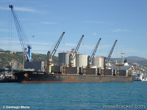
Vessel Dong Thanh IMO: 9180035, MMSI: 357276000 Bulk Carrier
UTC, 1.26777, 103.90108, course: 49, speed: 0
UTC, 1.26763, 103.90082, course: 49, speed: 0
2026-02-19 03:25:57 UTC, 1.24532, 103.95475, course: 125, speed: 7.8
Live AIS position:
UTC. Near BATU AMPAR),
updated 2026-02-19 03:25:57 UTC.
Find the position of the vessel Dong Thanh on the map. The latter are known coordinates and path.
marine traffic ship tracker show on live map
The current position of vessel Dong Thanh is 1.24532 lat / 103.95475 lng. Updated: 2026-02-19 03:25:57 UTCDetails:
Last coordinates of the vessel:
UTC, 1.26763, 103.90088, course: 52, speed: 0UTC, 1.26777, 103.90108, course: 49, speed: 0
UTC, 1.26763, 103.90082, course: 49, speed: 0
2026-02-19 03:25:57 UTC, 1.24532, 103.95475, course: 125, speed: 7.8