 vesseltracker.com
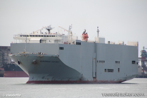
Vessel European Highway IMO: 9206011, MMSI: 357900000 Vehicles Carrier
UTC, -6.01320, 106.91767, course: 202, speed: 0.1
UTC, -6.01400, 106.91801, course: 315, speed: 0.1
2026-01-29 19:30:19 UTC, -6.01225, 106.91869, course: 225, speed: 0.1
Live AIS position:
UTC. Near New Priok Port),
updated 2026-01-29 19:30:19 UTC.
Find the position of the vessel European Highway on the map. The latter are known coordinates and path.
marine traffic ship tracker show on live map
The current position of vessel European Highway is -6.01225 lat / 106.91869 lng. Updated: 2026-01-29 19:30:19 UTCCurrently sailing under the flag of Panama
European Highway built in 1999 year
Deadweight:
15075 tDetails:
Last coordinates of the vessel:
UTC, -6.01327, 106.91792, course: 241, speed: 0.1UTC, -6.01320, 106.91767, course: 202, speed: 0.1
UTC, -6.01400, 106.91801, course: 315, speed: 0.1
2026-01-29 19:30:19 UTC, -6.01225, 106.91869, course: 225, speed: 0.1