 vesseltracker.com
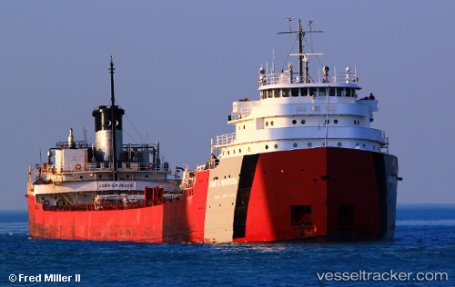
Vessel John G Munson IMO: 5173670, MMSI: 366971360 Self Discharging Bulk Carrier
UTC, 41.69444, -83.46023, course: -1, speed: 0
UTC, 41.69447, -83.46023, course: -1, speed: 0
2026-02-09 18:25:07 UTC, 41.69441, -83.46024, course: -1, speed: 0
Live AIS position:
UTC. Near Northwood, Wood),
updated 2026-02-09 18:25:07 UTC.
Find the position of the vessel John G Munson on the map. The latter are known coordinates and path.
marine traffic ship tracker show on live map
The current position of vessel John G Munson is 41.69441 lat / -83.46024 lng. Updated: 2026-02-09 18:25:07 UTCCurrently sailing under the flag of USA
John G Munson built in 1952 year
Deadweight:
26011 tDetails:
Last coordinates of the vessel:
UTC, 41.69446, -83.46026, course: -1, speed: 0UTC, 41.69444, -83.46023, course: -1, speed: 0
UTC, 41.69447, -83.46023, course: -1, speed: 0
2026-02-09 18:25:07 UTC, 41.69441, -83.46024, course: -1, speed: 0