 vesseltracker.com
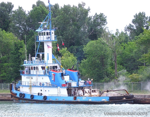
Vessel Allie B IMO: 7626279, MMSI: 367137180 Tug
UTC, 36.96160, -76.40946, course: 16, speed: 0
UTC, 36.96160, -76.40946, course: 20, speed: 0
2026-02-14 15:56:33 UTC, 36.96157, -76.40946, course: 22, speed: 0
Live AIS position:
UTC. Near Newport News),
updated 2026-02-14 15:56:33 UTC.
Find the position of the vessel Allie B on the map. The latter are known coordinates and path.
marine traffic ship tracker show on live map
The current position of vessel Allie B is 36.96157 lat / -76.40946 lng. Updated: 2026-02-14 15:56:33 UTCCurrently sailing under the flag of USA
Allie B built in 1977 year
Details:
Last coordinates of the vessel:
UTC, 36.96160, -76.40948, course: 16, speed: 0UTC, 36.96160, -76.40946, course: 16, speed: 0
UTC, 36.96160, -76.40946, course: 20, speed: 0
2026-02-14 15:56:33 UTC, 36.96157, -76.40946, course: 22, speed: 0