 vesseltracker.com
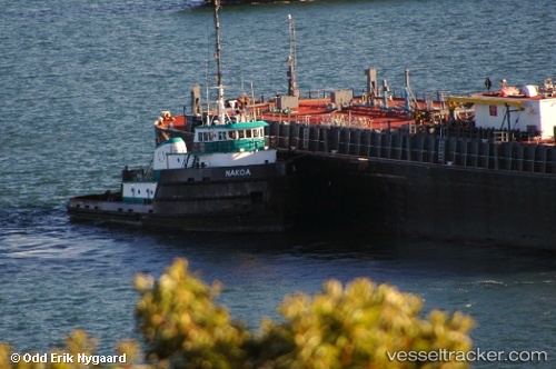
Vessel Nakoa IMO: 7626231, MMSI: 367309120 Tug
UTC, 21.75667, -69.11167, course: -1, speed: 9
UTC, 21.60333, -68.90500, course: -1, speed: 9
2026-02-18 02:27:24 UTC, 21.29422, -68.49748, course: 122, speed: 10.4
Live AIS position:
UTC. 131 nm NE of El Portillo/Samana),
updated 2026-02-18 02:27:24 UTC.
Find the position of the vessel Nakoa on the map. The latter are known coordinates and path.
marine traffic ship tracker show on live map
The current position of vessel Nakoa is 21.29422 lat / -68.49748 lng. Updated: 2026-02-18 02:27:24 UTCDetails:
Last coordinates of the vessel:
UTC, 21.95667, -69.37167, course: -1, speed: 9UTC, 21.75667, -69.11167, course: -1, speed: 9
UTC, 21.60333, -68.90500, course: -1, speed: 9
2026-02-18 02:27:24 UTC, 21.29422, -68.49748, course: 122, speed: 10.4