 vesseltracker.com
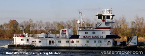
Vessel Ronald L Sensenbach IMO: 8845339, MMSI: 367533170 Tug
UTC, 36.97986, -88.03248, course: 340, speed: 6.7
UTC, 37.06343, -88.07320, course: 37, speed: 0
2026-02-10 14:05:57 UTC, 37.05265, -88.08767, course: 299, speed: 0
Live AIS position:
UTC. Near Grand Rivers),
updated 2026-02-10 14:05:57 UTC.
Find the position of the vessel Ronald L Sensenbach on the map. The latter are known coordinates and path.
marine traffic ship tracker show on live map
The current position of vessel Ronald L Sensenbach is 37.05265 lat / -88.08767 lng. Updated: 2026-02-10 14:05:57 UTCDetails:
Last coordinates of the vessel:
UTC, 36.73762, -87.97153, course: 9, speed: 7UTC, 36.97986, -88.03248, course: 340, speed: 6.7
UTC, 37.06343, -88.07320, course: 37, speed: 0
2026-02-10 14:05:57 UTC, 37.05265, -88.08767, course: 299, speed: 0