 vesseltracker.com
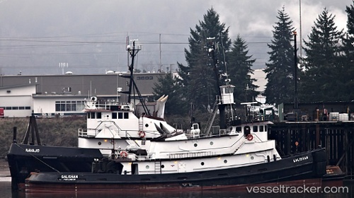
Vessel JULIE F IMO: 7398573, MMSI: 368198810 Tug
UTC, 33.33013, -76.97370, course: 32, speed: 9.8
UTC, 33.57593, -76.71195, course: 38, speed: 10
2026-02-26 23:54:01 UTC, 33.85333, -76.39833, course: -1, speed: 8
Live AIS position:
UTC. 50 nm S of Morehead City),
updated 2026-02-26 23:54:01 UTC.
Find the position of the vessel JULIE F on the map. The latter are known coordinates and path.
marine traffic ship tracker show on live map
The current position of vessel JULIE F is 33.85333 lat / -76.39833 lng. Updated: 2026-02-26 23:54:01 UTCCurrently sailing under the flag of United States of America
JULIE F built in 1973 year
Deadweight:
0 tDetails:
Last coordinates of the vessel:
UTC, 33.18667, -77.10833, course: -1, speed: 10UTC, 33.33013, -76.97370, course: 32, speed: 9.8
UTC, 33.57593, -76.71195, course: 38, speed: 10
2026-02-26 23:54:01 UTC, 33.85333, -76.39833, course: -1, speed: 8