 vesseltracker.com
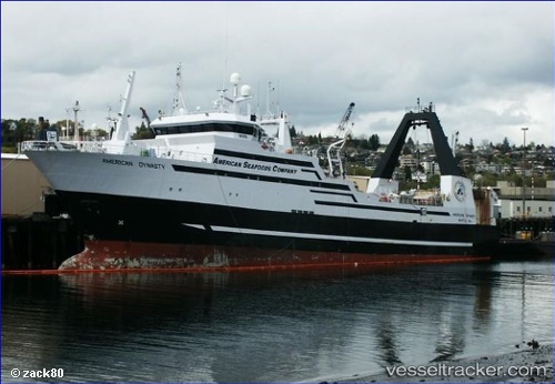
Vessel American Dynasty IMO: 7390428, MMSI: 368272000 Fishing Vessel
UTC, 56.63797, -168.42294, course: 160, speed: 4.4
UTC, 56.63797, -168.42294, course: 160, speed: 4.4
2026-02-13 14:53:03 UTC, 56.63797, -168.42294, course: 160, speed: 4.4
Live AIS position:
UTC. 176 nm NW of Akutan),
updated 2026-02-13 14:53:03 UTC.
Find the position of the vessel American Dynasty on the map. The latter are known coordinates and path.
marine traffic ship tracker show on live map
The current position of vessel American Dynasty is 56.63797 lat / -168.42294 lng. Updated: 2026-02-13 14:53:03 UTCDetails:
Last coordinates of the vessel:
UTC, 56.70363, -168.52711, course: 194, speed: 3.7UTC, 56.63797, -168.42294, course: 160, speed: 4.4
UTC, 56.63797, -168.42294, course: 160, speed: 4.4
2026-02-13 14:53:03 UTC, 56.63797, -168.42294, course: 160, speed: 4.4