 Wangaratta
Current Status
Where is the vessel?
Wangaratta is currently in Near Alcantara, based on AIS data received about 14h ago.
Latest AIS update:
Current position: 2.37687° S, 44.34558° W (Near Alcantara)
Average speed (last 7 days): Loading…
Average speed (last 30 days): Loading…
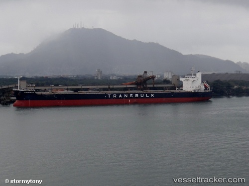
Vessel profile: Wangaratta is a Bulk Carrier with dimensions 229m x 32m.
This page combines live AIS, route history, probable destination signals, nearby traffic, and port activity for practical vessel monitoring.
The current position of vessel Wangaratta is -2.37687 lat / -44.34558 lng. Updated: 2026-05-23 13:44:35 UTCNearest reference points:
- 53 nm N of Beija-Flor
Currently sailing under the flag of Panama ![]()
Wangaratta built in 2011 year
Deadweight:
82206 tDetails:
Live Vessel Wangaratta Analytics (details, animations, etc.)
Recent AIS points (UTC):
2026-05-23 09:42:20 UTC · -2.37258, -44.34298 · SOG 0 kn · COG 206°2026-05-23 10:30:22 UTC · -2.37412, -44.34601 · SOG 0.8 kn · COG 99°
2026-05-23 11:48:22 UTC · -2.37626, -44.34528 · SOG 0 kn · COG 40°
2026-05-23 13:44:35 UTC · -2.37687, -44.34558 · SOG 0 kn · COG 39°