 vesseltracker.com
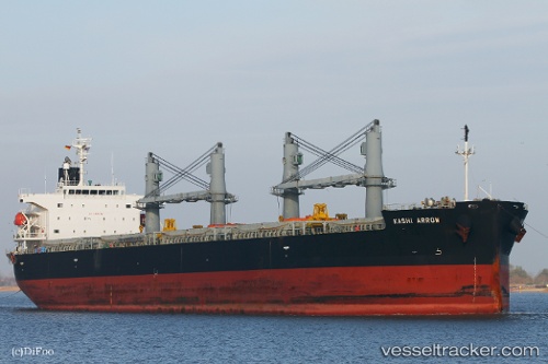
Vessel Kashi Arrow IMO: 9385491, MMSI: 370662000 General Cargo Ship
UTC, 11.66777, 43.18212, course: 94, speed: 0
UTC, 11.66842, 43.18238, course: 123, speed: 0
2026-02-21 03:49:47 UTC, 11.66848, 43.18242, course: 123, speed: 0
Live AIS position:
UTC. Near Djibouti),
updated 2026-02-21 03:49:47 UTC.
Find the position of the vessel Kashi Arrow on the map. The latter are known coordinates and path.
marine traffic ship tracker show on live map
The current position of vessel Kashi Arrow is 11.66848 lat / 43.18242 lng. Updated: 2026-02-21 03:49:47 UTCDetails:
Last coordinates of the vessel:
UTC, 11.66778, 43.18215, course: 93, speed: 0UTC, 11.66777, 43.18212, course: 94, speed: 0
UTC, 11.66842, 43.18238, course: 123, speed: 0
2026-02-21 03:49:47 UTC, 11.66848, 43.18242, course: 123, speed: 0