 vesseltracker.com
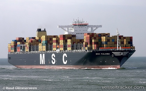
Vessel Msc Paloma IMO: 9441001, MMSI: 371233000 Container Ship
UTC, 24.98652, 55.05837, course: 339, speed: 0
UTC, 24.98652, 55.05837, course: 339, speed: 0
2026-01-24 03:50:27 UTC, 24.98654, 55.05837, course: 339, speed: 0
Live AIS position:
UTC. Near Jebel Ali Free Zone),
updated 2026-01-24 03:50:27 UTC.
Find the position of the vessel Msc Paloma on the map. The latter are known coordinates and path.
marine traffic ship tracker show on live map
The current position of vessel Msc Paloma is 24.98654 lat / 55.05837 lng. Updated: 2026-01-24 03:50:27 UTCCurrently sailing under the flag of Panama
Msc Paloma built in 2010 year
Deadweight:
165564 tDetails:
Last coordinates of the vessel:
UTC, 24.98654, 55.05839, course: 339, speed: 0UTC, 24.98652, 55.05837, course: 339, speed: 0
UTC, 24.98652, 55.05837, course: 339, speed: 0
2026-01-24 03:50:27 UTC, 24.98654, 55.05837, course: 339, speed: 0