 vesseltracker.com
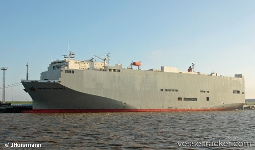
Vessel Shanghai Highway IMO: 9294343, MMSI: 371318000 Vehicles Carrier
UTC, 36.53209, 125.83090, course: 202, speed: 17.8
UTC, 35.99377, 125.50706, course: 205, speed: 18.3
2026-02-10 17:07:01 UTC, 35.62660, 125.29398, course: 210, speed: 18.5
Live AIS position:
UTC. 41 nm W of Sangwangdeungdo),
updated 2026-02-10 17:07:01 UTC.
Find the position of the vessel Shanghai Highway on the map. The latter are known coordinates and path.
marine traffic ship tracker show on live map
The current position of vessel Shanghai Highway is 35.62660 lat / 125.29398 lng. Updated: 2026-02-10 17:07:01 UTCCurrently sailing under the flag of Panama
Shanghai Highway built in 2005 year
Deadweight:
15413 tDetails:
Last coordinates of the vessel:
UTC, 36.96227, 126.03470, course: 208, speed: 17.3UTC, 36.53209, 125.83090, course: 202, speed: 17.8
UTC, 35.99377, 125.50706, course: 205, speed: 18.3
2026-02-10 17:07:01 UTC, 35.62660, 125.29398, course: 210, speed: 18.5