 vesseltracker.com
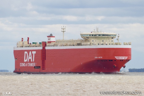
Vessel Dong A Metis IMO: 9419747, MMSI: 372997000 Vehicles Carrier
UTC, 41.43613, 5.96467, course: 159, speed: 17.5
UTC, 40.79198, 6.33385, course: 160, speed: 17.8
2026-02-23 21:55:02 UTC, 40.34562, 6.59108, course: 159, speed: 17.2
Live AIS position:
UTC. 34 nm NE of Mirabel),
updated 2026-02-23 21:55:02 UTC.
Find the position of the vessel Dong A Metis on the map. The latter are known coordinates and path.
marine traffic ship tracker show on live map
The current position of vessel Dong A Metis is 40.34562 lat / 6.59108 lng. Updated: 2026-02-23 21:55:02 UTCCurrently sailing under the flag of Panama
Dong A Metis built in 2010 year
Deadweight:
22582 tDetails:
Last coordinates of the vessel:
UTC, 41.92631, 5.68156, course: 157, speed: 17.7UTC, 41.43613, 5.96467, course: 159, speed: 17.5
UTC, 40.79198, 6.33385, course: 160, speed: 17.8
2026-02-23 21:55:02 UTC, 40.34562, 6.59108, course: 159, speed: 17.2