 vesseltracker.com
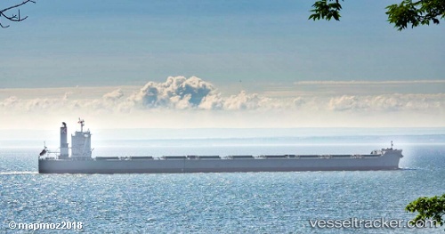
Vessel Cape Sunrise IMO: 9605009, MMSI: 373058000 Bulk Carrier
UTC, -32.67053, 18.03193, course: 243, speed: 0
UTC, -32.66959, 18.03098, course: 216, speed: 0
2026-02-17 16:00:18 UTC, -32.66899, 18.02947, course: 185, speed: 0.1
Live AIS position:
UTC. Near Saint Helena Bay),
updated 2026-02-17 16:00:18 UTC.
Find the position of the vessel Cape Sunrise on the map. The latter are known coordinates and path.
marine traffic ship tracker show on live map
The current position of vessel Cape Sunrise is -32.66899 lat / 18.02947 lng. Updated: 2026-02-17 16:00:18 UTCDetails:
Last coordinates of the vessel:
UTC, -32.67201, 18.03171, course: 274, speed: 0UTC, -32.67053, 18.03193, course: 243, speed: 0
UTC, -32.66959, 18.03098, course: 216, speed: 0
2026-02-17 16:00:18 UTC, -32.66899, 18.02947, course: 185, speed: 0.1