 vesseltracker.com
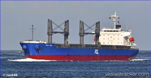
Vessel Ikan Jubal IMO: 9537018, MMSI: 373061000 General Cargo Ship
UTC, 2.97950, 101.32447, course: 234, speed: 0.1
UTC, 2.97953, 101.32442, course: 234, speed: 0.1
2026-02-17 21:29:27 UTC, 2.97954, 101.32446, course: 234, speed: 0
Live AIS position:
UTC. Near PORT KLANG),
updated 2026-02-17 21:29:27 UTC.
Find the position of the vessel Ikan Jubal on the map. The latter are known coordinates and path.
marine traffic ship tracker show on live map
The current position of vessel Ikan Jubal is 2.97954 lat / 101.32446 lng. Updated: 2026-02-17 21:29:27 UTCDetails:
Last coordinates of the vessel:
UTC, 2.97954, 101.32441, course: 234, speed: 0.1UTC, 2.97950, 101.32447, course: 234, speed: 0.1
UTC, 2.97953, 101.32442, course: 234, speed: 0.1
2026-02-17 21:29:27 UTC, 2.97954, 101.32446, course: 234, speed: 0