 vesseltracker.com
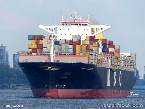
Vessel Msc Regulus IMO: 9465291, MMSI: 373068000 Container Ship
UTC, 5.94162, 86.43762, course: 91, speed: 18.2
UTC, 5.94174, 86.89478, course: 89, speed: 17.9
2026-02-18 09:16:56 UTC, 5.95167, 87.31333, course: -1, speed: 18
Live AIS position:
UTC. 82 nm E of Abakaliki),
updated 2026-02-18 09:16:56 UTC.
Find the position of the vessel Msc Regulus on the map. The latter are known coordinates and path.
marine traffic ship tracker show on live map
The current position of vessel Msc Regulus is 5.95167 lat / 87.31333 lng. Updated: 2026-02-18 09:16:56 UTCDetails:
Last coordinates of the vessel:
UTC, 5.93037, 85.55619, course: 91, speed: 17.9UTC, 5.94162, 86.43762, course: 91, speed: 18.2
UTC, 5.94174, 86.89478, course: 89, speed: 17.9
2026-02-18 09:16:56 UTC, 5.95167, 87.31333, course: -1, speed: 18