 vesseltracker.com
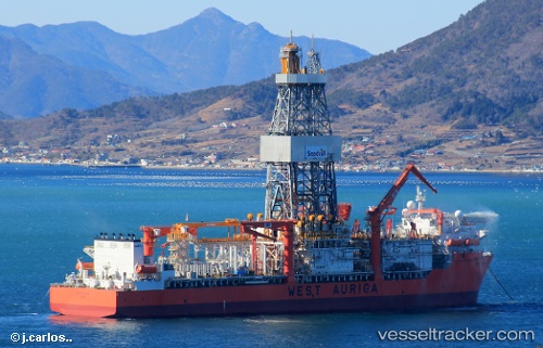
Vessel WEST AURIGA IMO: 9609392, MMSI: 373287000 Drill Ship
UTC, -24.81573, -42.50574, course: -1, speed: 0.2
UTC, -24.81572, -42.50571, course: -1, speed: 0.1
2026-02-28 10:12:19 UTC, -24.81571, -42.50574, course: -1, speed: 0.2
Live AIS position:
UTC. 47 nm NE of Cidade de Angra dos Reis FPSO),
updated 2026-02-28 10:12:19 UTC.
Find the position of the vessel WEST AURIGA on the map. The latter are known coordinates and path.
marine traffic ship tracker show on live map
The current position of vessel WEST AURIGA is -24.81571 lat / -42.50574 lng. Updated: 2026-02-28 10:12:19 UTCCurrently sailing under the flag of Panama
Details:
Last coordinates of the vessel:
UTC, -24.81571, -42.50576, course: -1, speed: 0.2UTC, -24.81573, -42.50574, course: -1, speed: 0.2
UTC, -24.81572, -42.50571, course: -1, speed: 0.1
2026-02-28 10:12:19 UTC, -24.81571, -42.50574, course: -1, speed: 0.2