 vesseltracker.com
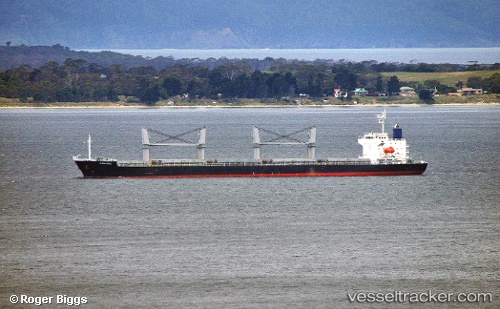
Vessel Ocean Hope IMO: 9527207, MMSI: 373402000 General Cargo Ship
UTC, 30.89648, 123.22830, course: 175, speed: 11.5
UTC, 30.66818, 123.17263, course: -1, speed: 12.3
2026-02-27 14:04:50 UTC, 30.11500, 123.09167, course: -1, speed: 12
Live AIS position:
UTC. 44 nm E of JINHAI HEAVY INDUSTR),
updated 2026-02-27 14:04:50 UTC.
Find the position of the vessel Ocean Hope on the map. The latter are known coordinates and path.
marine traffic ship tracker show on live map
The current position of vessel Ocean Hope is 30.11500 lat / 123.09167 lng. Updated: 2026-02-27 14:04:50 UTCDetails:
Last coordinates of the vessel:
UTC, 31.09477, 122.93042, course: 86, speed: 9UTC, 30.89648, 123.22830, course: 175, speed: 11.5
UTC, 30.66818, 123.17263, course: -1, speed: 12.3
2026-02-27 14:04:50 UTC, 30.11500, 123.09167, course: -1, speed: 12