 vesseltracker.com
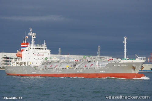
Vessel Buena Alba IMO: 9643972, MMSI: 373933000 Lpg Tanker
UTC, 38.21283, 141.15105, course: 149, speed: 0.1
UTC, 38.21284, 141.15121, course: 159, speed: 0.2
2026-02-22 13:43:27 UTC, 38.21276, 141.15112, course: 154, speed: 0.2
Live AIS position:
UTC. Near SENDAI),
updated 2026-02-22 13:43:27 UTC.
Find the position of the vessel Buena Alba on the map. The latter are known coordinates and path.
marine traffic ship tracker show on live map
The current position of vessel Buena Alba is 38.21276 lat / 141.15112 lng. Updated: 2026-02-22 13:43:27 UTCCurrently sailing under the flag of Panama
Details:
Last coordinates of the vessel:
UTC, 38.21221, 141.15099, course: 132, speed: 0.2UTC, 38.21283, 141.15105, course: 149, speed: 0.1
UTC, 38.21284, 141.15121, course: 159, speed: 0.2
2026-02-22 13:43:27 UTC, 38.21276, 141.15112, course: 154, speed: 0.2