 vesseltracker.com
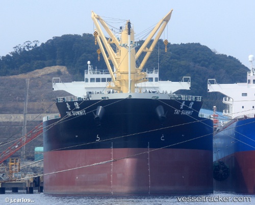
Vessel Tai Summit IMO: 9727144, MMSI: 374458000 Bulk Carrier
UTC, -31.29595, 33.27203, course: 64, speed: 10.9
UTC, -31.07303, 33.81989, course: 66, speed: 10.9
2026-02-08 12:26:16 UTC, -30.92122, 34.20077, course: 70, speed: 11.2
Live AIS position:
UTC. 165 nm SE of Richards Bay),
updated 2026-02-08 12:26:16 UTC.
Find the position of the vessel Tai Summit on the map. The latter are known coordinates and path.
marine traffic ship tracker show on live map
The current position of vessel Tai Summit is -30.92122 lat / 34.20077 lng. Updated: 2026-02-08 12:26:16 UTCDetails:
Last coordinates of the vessel:
UTC, -31.44737, 32.90001, course: 62, speed: 10.6UTC, -31.29595, 33.27203, course: 64, speed: 10.9
UTC, -31.07303, 33.81989, course: 66, speed: 10.9
2026-02-08 12:26:16 UTC, -30.92122, 34.20077, course: 70, speed: 11.2