 vesseltracker.com
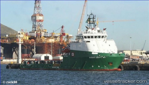
Vessel Bourbon Liberty 161 IMO: 9639191, MMSI: 375047000 Offshore Tug Supply Ship
UTC, -5.25387, 11.85013, course: 327, speed: 0.7
UTC, -5.33863, 11.86633, course: 162, speed: 2.3
2026-02-17 20:14:12 UTC, -5.42895, 11.88063, course: 163, speed: 3.5
Live AIS position:
UTC. 18 nm W of Futila Terminal),
updated 2026-02-17 20:14:12 UTC.
Find the position of the vessel Bourbon Liberty 161 on the map. The latter are known coordinates and path.
marine traffic ship tracker show on live map
The current position of vessel Bourbon Liberty 161 is -5.42895 lat / 11.88063 lng. Updated: 2026-02-17 20:14:12 UTCCurrently sailing under the flag of St Vincent Grenadines
Bourbon Liberty 161 built in 2014 year
Deadweight:
1703 tDetails:
Last coordinates of the vessel:
UTC, -5.25333, 11.85167, course: -1, speed: 0UTC, -5.25387, 11.85013, course: 327, speed: 0.7
UTC, -5.33863, 11.86633, course: 162, speed: 2.3
2026-02-17 20:14:12 UTC, -5.42895, 11.88063, course: 163, speed: 3.5