 vesseltracker.com
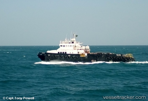
Vessel Firecrest IMO: 9467847, MMSI: 376851000 Offshore Tug Supply Ship
UTC, 28.24293, 49.23961, course: 312, speed: 0.8
UTC, 28.24300, 49.25042, course: 165, speed: 0.6
2026-01-29 06:47:37 UTC, 28.24094, 49.24986, course: 170, speed: 1.1
Live AIS position:
UTC. 29 nm E of Bandar Al Mishab),
updated 2026-01-29 06:47:37 UTC.
Find the position of the vessel Firecrest on the map. The latter are known coordinates and path.
marine traffic ship tracker show on live map
The current position of vessel Firecrest is 28.24094 lat / 49.24986 lng. Updated: 2026-01-29 06:47:37 UTCDetails:
Last coordinates of the vessel:
UTC, 28.21626, 49.30801, course: 158, speed: 3.1UTC, 28.24293, 49.23961, course: 312, speed: 0.8
UTC, 28.24300, 49.25042, course: 165, speed: 0.6
2026-01-29 06:47:37 UTC, 28.24094, 49.24986, course: 170, speed: 1.1