 vesseltracker.com
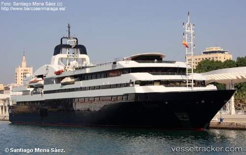
Vessel Turama IMO: 8907216, MMSI: 403051000 Cruise Ship
UTC, 27.49545, 34.06875, course: 135, speed: 14.2
UTC, 27.49545, 34.06875, course: 135, speed: 14.2
2026-02-25 06:36:40 UTC, 27.49545, 34.06875, course: 135, speed: 14.2
Live AIS position:
UTC. 19 nm NE of Al Gurdagah),
updated 2026-02-25 06:36:40 UTC.
Find the position of the vessel Turama on the map. The latter are known coordinates and path.
marine traffic ship tracker show on live map
The current position of vessel Turama is 27.49545 lat / 34.06875 lng. Updated: 2026-02-25 06:36:40 UTCDetails:
Last coordinates of the vessel:
UTC, 27.93049, 33.58398, course: 132, speed: 14.6UTC, 27.49545, 34.06875, course: 135, speed: 14.2
UTC, 27.49545, 34.06875, course: 135, speed: 14.2
2026-02-25 06:36:40 UTC, 27.49545, 34.06875, course: 135, speed: 14.2