.
vessel '405000333' IMO: 9668051, vesseltracker.com
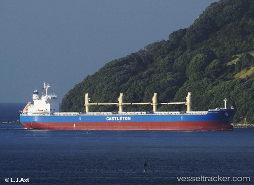
Vessel '405000333' IMO: 9668051, MMSI: 405000333

callsign:
size: x

Live AIS position: UTC. 110 nm SE of KIJANG), updated 2026-02-14 21:53:32 UTC.

Find the position of the vessel '405000333' on the map. The latter are known coordinates and path.

marine traffic ship tracker show on live map

The current position of vessel '405000333' is 0.13921 lat / 106.29247 lng. Updated: 2026-02-14 21:53:32 UTC
Details:


Last coordinates of the vessel:
UTC, -0.63064, 107.04613, course: 319, speed: 10.3
UTC, -0.29353, 106.73546, course: 313, speed: 10.3
UTC, -0.08090, 106.50965, course: 318, speed: 10.5
2026-02-14 21:53:32 UTC, 0.13921, 106.29247, course: 318, speed: 10.8


Most frequent ports a vessels calls at '405000333' (405000333):

Sambu, traffic: 4
Jubail, traffic: 3
Al Jubayl, traffic: 3
Douala, traffic: 3
Singapore, traffic: 3
Haldia, traffic: 3
Karachi, traffic: 2
Mina Saqr, traffic: 2
Port Louis, traffic: 2
Saldanha Bay, traffic: 2
Krishnapatnam, traffic: 2
Paradip, traffic: 1
Algeciras, traffic: 1
Port Said, traffic: 1
Bur Ibrahim, traffic: 1

Link to the map:


Find another ship

'405000333' (405000333) last ports (portcalls and passsages)

Singapore | 2024-01-06 06:46:27
Paradip | 2023-12-29 09:28:44
Haldia | 2023-12-26 03:17:04
Krishnapatnam | 2023-12-16 13:01:01
Krishnapatnam | 2023-12-12 06:25:46
Algeciras | 2022-12-26 20:29:29
Port Said | 2022-12-16 08:18:17
Bur Ibrahim | 2022-12-02 02:16:50
Jubail | 2022-11-15 23:16:36
Jubail | 2022-11-11 20:46:42
Jubail | 2022-11-07 20:21:07
Singapore | 2022-09-30 04:47:06
Singapore | 2022-08-28 22:59:10
Cape Of Good Hope | 2022-08-04 07:47:52
Saldanha Bay | 2022-08-03 22:49:52
Saldanha Bay | 2022-07-26 23:11:14
Douala | 2022-07-11 13:02:02
Douala | 2022-07-07 10:36:46
Douala | 2022-07-03 07:21:53
Fujairah | 2022-06-08 10:38:58
Sambu | 2022-04-04 06:00:14
Mina Saqr | 2022-03-10 06:00:22
Karachi | 2022-01-11 15:18:51
Haldia | 2021-12-31 02:39:42
Port Louis | 2021-12-01 00:20:39