 vesseltracker.com
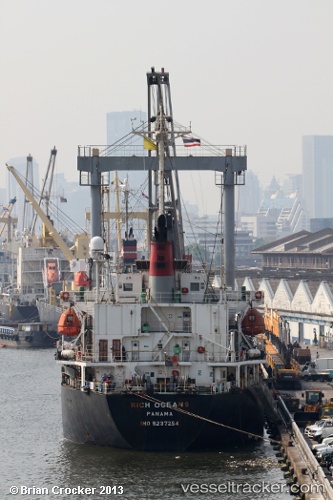
Vessel APARAJITA IMO: 9237254, MMSI: 405000367 General Cargo Ship
UTC, 22.23945, 91.76903, course: 332, speed: 0
UTC, 22.23978, 91.76936, course: 319, speed: 0.1
2026-02-13 12:11:42 UTC, 22.24145, 91.76862, course: 193, speed: 0.1
Live AIS position:
UTC. Near Chittagong),
updated 2026-02-13 12:11:42 UTC.
Find the position of the vessel APARAJITA on the map. The latter are known coordinates and path.
marine traffic ship tracker show on live map
The current position of vessel APARAJITA is 22.24145 lat / 91.76862 lng. Updated: 2026-02-13 12:11:42 UTCCurrently sailing under the flag of Bangladesh
APARAJITA built in 2000 year
Deadweight:
9998 tDetails:
Last coordinates of the vessel:
UTC, 22.23966, 91.76900, course: 322, speed: 0.1UTC, 22.23945, 91.76903, course: 332, speed: 0
UTC, 22.23978, 91.76936, course: 319, speed: 0.1
2026-02-13 12:11:42 UTC, 22.24145, 91.76862, course: 193, speed: 0.1