 vesseltracker.com
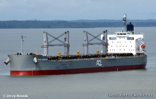
Vessel RUBAIYAT HANIF IMO: 9403047, MMSI: 405000375 Bulk Carrier
UTC, -6.53697, 49.04140, course: -1, speed: 12.8
UTC, -6.53697, 49.04140, course: -1, speed: 12.8
2026-02-27 23:40:56 UTC, -6.53697, 49.04140, course: -1, speed: 12.8
Live AIS position:
UTC. 282 nm W of Ile Desroches),
updated 2026-02-27 23:40:56 UTC.
Find the position of the vessel RUBAIYAT HANIF on the map. The latter are known coordinates and path.
marine traffic ship tracker show on live map
The current position of vessel RUBAIYAT HANIF is -6.53697 lat / 49.04140 lng. Updated: 2026-02-27 23:40:56 UTCCurrently sailing under the flag of Bangladesh
RUBAIYAT HANIF built in 2008 year
Deadweight:
58713 tDetails:
Last coordinates of the vessel:
UTC, -6.01095, 49.39398, course: -1, speed: 12.3UTC, -6.53697, 49.04140, course: -1, speed: 12.8
UTC, -6.53697, 49.04140, course: -1, speed: 12.8
2026-02-27 23:40:56 UTC, -6.53697, 49.04140, course: -1, speed: 12.8