 vesseltracker.com
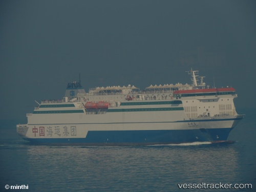
Vessel Yong Xing Dao IMO: 9517329, MMSI: 412091000 Passenger Ro Ro Cargo Ship
UTC, 38.92148, 121.76475, course: 185, speed: 15.7
UTC, 38.37683, 121.92413, course: 161, speed: 15.4
2026-01-29 05:21:55 UTC, 38.10615, 122.03643, course: 175, speed: 15.2
Live AIS position:
UTC. 33 nm N of Weihaiwei),
updated 2026-01-29 05:21:55 UTC.
Find the position of the vessel Yong Xing Dao on the map. The latter are known coordinates and path.
marine traffic ship tracker show on live map
The current position of vessel Yong Xing Dao is 38.10615 lat / 122.03643 lng. Updated: 2026-01-29 05:21:55 UTCCurrently sailing under the flag of China
Yong Xing Dao built in 2011 year
Deadweight:
7662 tDetails:
Last coordinates of the vessel:
UTC, 39.03020, 121.73532, course: 310, speed: 0UTC, 38.92148, 121.76475, course: 185, speed: 15.7
UTC, 38.37683, 121.92413, course: 161, speed: 15.4
2026-01-29 05:21:55 UTC, 38.10615, 122.03643, course: 175, speed: 15.2