 vesseltracker.com
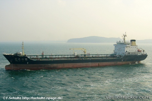
Vessel HONGDAHAI10 IMO: 9536351, MMSI: 413384160 Tanker
UTC, 35.27886, 120.56309, course: -1, speed: 0.2
UTC, 35.27833, 120.56167, course: -1, speed: 0
2026-02-27 19:40:36 UTC, 35.27838, 120.56510, course: -1, speed: 0.1
Live AIS position:
UTC. 42 nm SE of DONGJIAKOU),
updated 2026-02-27 19:40:36 UTC.
Find the position of the vessel HONGDAHAI10 on the map. The latter are known coordinates and path.
marine traffic ship tracker show on live map
The current position of vessel HONGDAHAI10 is 35.27838 lat / 120.56510 lng. Updated: 2026-02-27 19:40:36 UTCCurrently sailing under the flag of China
Details:
Last coordinates of the vessel:
UTC, 35.27833, 120.56167, course: -1, speed: 0UTC, 35.27886, 120.56309, course: -1, speed: 0.2
UTC, 35.27833, 120.56167, course: -1, speed: 0
2026-02-27 19:40:36 UTC, 35.27838, 120.56510, course: -1, speed: 0.1