 vesseltracker.com
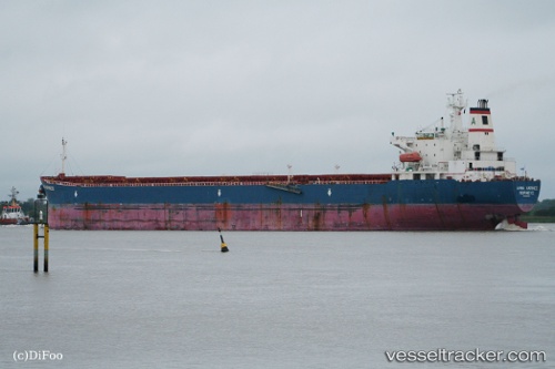
Vessel Jin Ning 17 IMO: 9189108, MMSI: 414283000 Bulk Carrier
UTC, 40.31176, 122.07564, course: 334, speed: 0
UTC, 40.31178, 122.07565, course: 334, speed: 0
2026-02-05 19:55:33 UTC, 40.31192, 122.07565, course: 334, speed: 0
Live AIS position:
UTC. Near Bayuquan),
updated 2026-02-05 19:55:33 UTC.
Find the position of the vessel Jin Ning 17 on the map. The latter are known coordinates and path.
marine traffic ship tracker show on live map
The current position of vessel Jin Ning 17 is 40.31192 lat / 122.07565 lng. Updated: 2026-02-05 19:55:33 UTCCurrently sailing under the flag of China
Jin Ning 17 built in 1999 year
Deadweight:
72893 tDetails:
Last coordinates of the vessel:
UTC, 40.31178, 122.07565, course: 334, speed: 0UTC, 40.31176, 122.07564, course: 334, speed: 0
UTC, 40.31178, 122.07565, course: 334, speed: 0
2026-02-05 19:55:33 UTC, 40.31192, 122.07565, course: 334, speed: 0