 vesseltracker.com
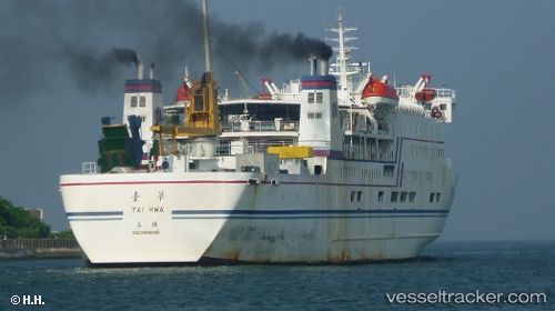
Vessel Tai Hwa IMO: 8811027, MMSI: 416100010 Passenger Ro Ro Cargo Ship
UTC, 23.17475, 119.60157, course: 135, speed: 0.5
UTC, 23.17475, 119.60157, course: 135, speed: 0.5
2026-01-29 11:44:16 UTC, 23.17475, 119.60157, course: 135, speed: 0.5
Live AIS position:
UTC. 23 nm S of MAGONG),
updated 2026-01-29 11:44:16 UTC.
Find the position of the vessel Tai Hwa on the map. The latter are known coordinates and path.
marine traffic ship tracker show on live map
The current position of vessel Tai Hwa is 23.17475 lat / 119.60157 lng. Updated: 2026-01-29 11:44:16 UTCCurrently sailing under the flag of Taiwan
Tai Hwa built in 1989 year
Deadweight:
2296 tDetails:
Last coordinates of the vessel:
UTC, 23.12573, 119.43682, course: 342, speed: 0.9UTC, 23.17475, 119.60157, course: 135, speed: 0.5
UTC, 23.17475, 119.60157, course: 135, speed: 0.5
2026-01-29 11:44:16 UTC, 23.17475, 119.60157, course: 135, speed: 0.5