 vesseltracker.com
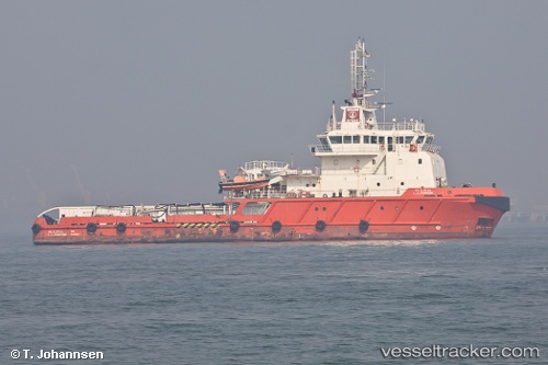
Vessel L J Johnson IMO: 9576363, MMSI: 419000208 Offshore Tug Supply Ship
UTC, 18.97438, 72.95362, course: 341, speed: 1.9
UTC, 18.84248, 72.73107, course: 267, speed: 7.6
2026-02-03 00:23:09 UTC, 18.88678, 72.50378, course: 350, speed: 5.6
Live AIS position:
UTC. 17 nm W of Air Parcel Sorting Office/Mumbai),
updated 2026-02-03 00:23:09 UTC.
Find the position of the vessel L J Johnson on the map. The latter are known coordinates and path.
marine traffic ship tracker show on live map
The current position of vessel L J Johnson is 18.88678 lat / 72.50378 lng. Updated: 2026-02-03 00:23:09 UTCDetails:
Last coordinates of the vessel:
UTC, 18.97337, 72.95533, course: 42, speed: 0UTC, 18.97438, 72.95362, course: 341, speed: 1.9
UTC, 18.84248, 72.73107, course: 267, speed: 7.6
2026-02-03 00:23:09 UTC, 18.88678, 72.50378, course: 350, speed: 5.6