 vesseltracker.com
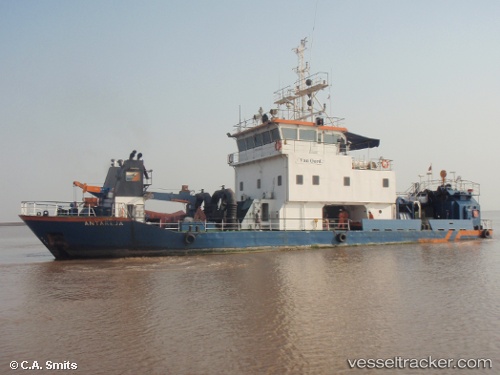
Vessel Antareja IMO: 9142679, MMSI: 419055600 Dredger
UTC, 18.97548, 72.91749, course: 48, speed: 0.7
UTC, 18.97276, 72.91596, course: 224, speed: 1.7
2026-01-23 18:58:50 UTC, 18.97594, 72.91818, course: 227, speed: 1.3
Live AIS position:
UTC. Near NHAVA SHEVA),
updated 2026-01-23 18:58:50 UTC.
Find the position of the vessel Antareja on the map. The latter are known coordinates and path.
marine traffic ship tracker show on live map
The current position of vessel Antareja is 18.97594 lat / 72.91818 lng. Updated: 2026-01-23 18:58:50 UTCDetails:
Last coordinates of the vessel:
UTC, 18.95574, 72.84889, course: 276, speed: 0.9UTC, 18.97548, 72.91749, course: 48, speed: 0.7
UTC, 18.97276, 72.91596, course: 224, speed: 1.7
2026-01-23 18:58:50 UTC, 18.97594, 72.91818, course: 227, speed: 1.3