 vesseltracker.com
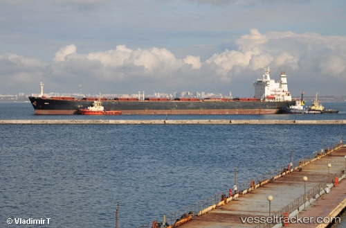
Vessel Andia IMO: 9193197, MMSI: 422039900 Bulk Carrier
UTC, 26.97679, 56.43980, course: 317, speed: 0
UTC, 26.97792, 56.44022, course: 280, speed: 0.1
2026-02-08 02:23:10 UTC, 26.97762, 56.44030, course: 291, speed: 0.1
Live AIS position:
UTC. Near LARAK),
updated 2026-02-08 02:23:10 UTC.
Find the position of the vessel Andia on the map. The latter are known coordinates and path.
marine traffic ship tracker show on live map
The current position of vessel Andia is 26.97762 lat / 56.44030 lng. Updated: 2026-02-08 02:23:10 UTCDetails:
Last coordinates of the vessel:
UTC, 26.98032, 56.43768, course: 201, speed: 0.1UTC, 26.97679, 56.43980, course: 317, speed: 0
UTC, 26.97792, 56.44022, course: 280, speed: 0.1
2026-02-08 02:23:10 UTC, 26.97762, 56.44030, course: 291, speed: 0.1