 vesseltracker.com
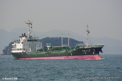
Vessel Miya Maru No.18 IMO: 9413872, MMSI: 431000196 Oil Products Tanker
UTC, 35.88219, 140.94514, course: 4, speed: 10.8
UTC, 36.42701, 140.99545, course: 3, speed: 12.1
2026-01-30 21:41:23 UTC, 36.77630, 141.03749, course: 4, speed: 13.1
Live AIS position:
UTC. 12 nm SE of ONAHAMA),
updated 2026-01-30 21:41:23 UTC.
Find the position of the vessel Miya Maru No.18 on the map. The latter are known coordinates and path.
marine traffic ship tracker show on live map
The current position of vessel Miya Maru No.18 is 36.77630 lat / 141.03749 lng. Updated: 2026-01-30 21:41:23 UTCDetails:
Last coordinates of the vessel:
UTC, 35.64214, 140.88348, course: 36, speed: 10.9UTC, 35.88219, 140.94514, course: 4, speed: 10.8
UTC, 36.42701, 140.99545, course: 3, speed: 12.1
2026-01-30 21:41:23 UTC, 36.77630, 141.03749, course: 4, speed: 13.1