 vesseltracker.com
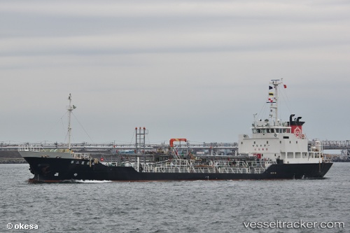
Vessel Ryoeimaru no.2 IMO: 9451836, MMSI: 431000224 Oil Products Tanker
UTC, 40.90535, 139.98192, course: 219, speed: 9.9
UTC, 40.58062, 139.75095, course: 191, speed: 11.3
2026-01-28 10:04:43 UTC, 39.94936, 139.61411, course: 181, speed: 10.2
Live AIS position:
UTC. 11 nm W of Oga),
updated 2026-01-28 10:04:43 UTC.
Find the position of the vessel Ryoeimaru no.2 on the map. The latter are known coordinates and path.
marine traffic ship tracker show on live map
The current position of vessel Ryoeimaru no.2 is 39.94936 lat / 139.61411 lng. Updated: 2026-01-28 10:04:43 UTCCurrently sailing under the flag of Japan
Details:
Last coordinates of the vessel:
UTC, 41.05622, 140.11031, course: 212, speed: 10UTC, 40.90535, 139.98192, course: 219, speed: 9.9
UTC, 40.58062, 139.75095, course: 191, speed: 11.3
2026-01-28 10:04:43 UTC, 39.94936, 139.61411, course: 181, speed: 10.2