 vesseltracker.com
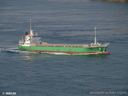
Vessel Senkomamaru IMO: 9457696, MMSI: 431000376 General Cargo Ship
UTC, 33.97533, 136.59117, course: 46, speed: 12.5
UTC, 34.20763, 136.89224, course: 35, speed: 11.3
2026-02-17 05:50:46 UTC, 34.57966, 136.98674, course: 312, speed: 13.9
Live AIS position:
UTC. Near Atumi),
updated 2026-02-17 05:50:46 UTC.
Find the position of the vessel Senkomamaru on the map. The latter are known coordinates and path.
marine traffic ship tracker show on live map
The current position of vessel Senkomamaru is 34.57966 lat / 136.98674 lng. Updated: 2026-02-17 05:50:46 UTCCurrently sailing under the flag of Japan
Details:
Last coordinates of the vessel:
UTC, 33.71479, 136.24281, course: 50, speed: 12.6UTC, 33.97533, 136.59117, course: 46, speed: 12.5
UTC, 34.20763, 136.89224, course: 35, speed: 11.3
2026-02-17 05:50:46 UTC, 34.57966, 136.98674, course: 312, speed: 13.9