 vesseltracker.com
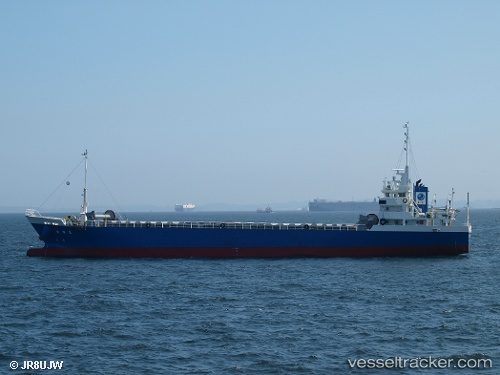
Vessel TOUKI MARU IMO: 9457701, MMSI: 431000411 General Cargo Ship
UTC, 34.50667, 133.67166, course: -1, speed: 0
UTC, 34.50727, 133.67194, course: 91, speed: 0
2026-01-30 15:35:46 UTC, 34.50667, 133.67166, course: -1, speed: 0
Live AIS position:
UTC. Near Kurashiki),
updated 2026-01-30 15:35:46 UTC.
Find the position of the vessel TOUKI MARU on the map. The latter are known coordinates and path.
marine traffic ship tracker show on live map
The current position of vessel TOUKI MARU is 34.50667 lat / 133.67166 lng. Updated: 2026-01-30 15:35:46 UTCCurrently sailing under the flag of Japan
TOUKI MARU built in 2008 year
Deadweight:
1750 tDetails:
Last coordinates of the vessel:
UTC, 34.50667, 133.67166, course: -1, speed: 0UTC, 34.50667, 133.67166, course: -1, speed: 0
UTC, 34.50727, 133.67194, course: 91, speed: 0
2026-01-30 15:35:46 UTC, 34.50667, 133.67166, course: -1, speed: 0