 vesseltracker.com
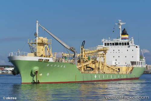
Vessel Sumisemaru No 7 IMO: 9459905, MMSI: 431000548 Cement Carrier
UTC, 34.17801, 136.84906, course: -1, speed: 13.1
UTC, 33.97456, 136.56911, course: -1, speed: 12.9
2026-03-21 18:37:34 UTC, 33.72194, 136.25069, course: 230, speed: 13.4
Live Vessel Sumisemaru No 7 Analytics (details, animations, etc.)
Live AIS position: UTC. 27 nm E of Minachi), updated 2026-03-21 18:37:34 UTC.Find the position of the vessel Sumisemaru No 7 on the map. The latter are known coordinates and path.
marine traffic ship tracker show on live map
The current position of vessel Sumisemaru No 7 is 33.72194 lat / 136.25069 lng. Updated: 2026-03-21 18:37:34 UTCDetails:
Last coordinates of the vessel:
UTC, 34.54903, 137.01599, course: 135, speed: 15.5UTC, 34.17801, 136.84906, course: -1, speed: 13.1
UTC, 33.97456, 136.56911, course: -1, speed: 12.9
2026-03-21 18:37:34 UTC, 33.72194, 136.25069, course: 230, speed: 13.4