 vesseltracker.com
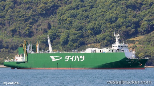
Vessel Daihatsu Maru 2 IMO: 9392121, MMSI: 431000981 Vehicles Carrier
UTC, 34.35230, 133.72749, course: 251, speed: 16.7
UTC, 34.18458, 133.20224, course: -1, speed: 14.8
2026-03-04 15:31:32 UTC, 34.00174, 132.73833, course: 221, speed: 17.2
Live Vessel Daihatsu Maru 2 Analytics (details, animations, etc.)
Live AIS position: UTC. Near KIKUMA), updated 2026-03-04 15:31:32 UTC.Find the position of the vessel Daihatsu Maru 2 on the map. The latter are known coordinates and path.
marine traffic ship tracker show on live map
The current position of vessel Daihatsu Maru 2 is 34.00174 lat / 132.73833 lng. Updated: 2026-03-04 15:31:32 UTCDetails:
Last coordinates of the vessel:
UTC, 34.42283, 134.18301, course: -1, speed: 17.3UTC, 34.35230, 133.72749, course: 251, speed: 16.7
UTC, 34.18458, 133.20224, course: -1, speed: 14.8
2026-03-04 15:31:32 UTC, 34.00174, 132.73833, course: 221, speed: 17.2