 vesseltracker.com
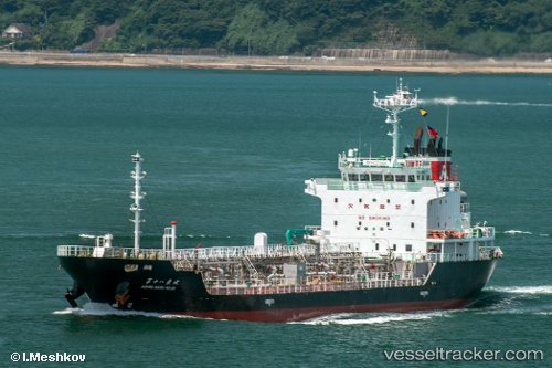
Vessel Azuma Maru No.18 IMO: 9511129, MMSI: 431001096 Oil Products Tanker
UTC, 34.34094, 134.98886, course: 194, speed: 15.1
UTC, 33.86299, 135.02032, course: 138, speed: 14.5
2026-02-13 12:00:44 UTC, 33.51192, 135.42732, course: 119, speed: 14.8
Live AIS position:
UTC. 23 nm SW of Minachi),
updated 2026-02-13 12:00:44 UTC.
Find the position of the vessel Azuma Maru No.18 on the map. The latter are known coordinates and path.
marine traffic ship tracker show on live map
The current position of vessel Azuma Maru No.18 is 33.51192 lat / 135.42732 lng. Updated: 2026-02-13 12:00:44 UTCDetails:
Last coordinates of the vessel:
UTC, 34.56133, 134.83417, course: 65, speed: 15UTC, 34.34094, 134.98886, course: 194, speed: 15.1
UTC, 33.86299, 135.02032, course: 138, speed: 14.5
2026-02-13 12:00:44 UTC, 33.51192, 135.42732, course: 119, speed: 14.8