 vesseltracker.com
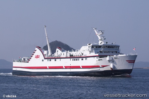
Vessel Manyou IMO: 9610133, MMSI: 431002428 Passenger Ro Ro Cargo Ship
UTC, 32.78364, 128.94868, course: 224, speed: 17.7
UTC, 32.71860, 129.01170, course: 90, speed: 18.1
2026-01-30 09:31:06 UTC, 32.71294, 129.79776, course: 103, speed: 18
Live AIS position:
UTC. Near FUKABORI),
updated 2026-01-30 09:31:06 UTC.
Find the position of the vessel Manyou on the map. The latter are known coordinates and path.
marine traffic ship tracker show on live map
The current position of vessel Manyou is 32.71294 lat / 129.79776 lng. Updated: 2026-01-30 09:31:06 UTCDetails:
Last coordinates of the vessel:
UTC, 32.76678, 129.40610, course: 268, speed: 17.8UTC, 32.78364, 128.94868, course: 224, speed: 17.7
UTC, 32.71860, 129.01170, course: 90, speed: 18.1
2026-01-30 09:31:06 UTC, 32.71294, 129.79776, course: 103, speed: 18