 vesseltracker.com
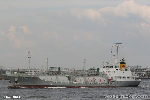
Vessel Marine Ace IMO: 9606572, MMSI: 431002799 Lpg Tanker
UTC, 34.40085, 133.19534, course: 85, speed: 0
UTC, 34.40077, 133.19534, course: 85, speed: 0
2026-02-14 13:58:58 UTC, 34.40073, 133.19531, course: 85, speed: 0
Live AIS position:
UTC. Near ONOMICHIITOZAKI),
updated 2026-02-14 13:58:58 UTC.
Find the position of the vessel Marine Ace on the map. The latter are known coordinates and path.
marine traffic ship tracker show on live map
The current position of vessel Marine Ace is 34.40073 lat / 133.19531 lng. Updated: 2026-02-14 13:58:58 UTCDetails:
Last coordinates of the vessel:
UTC, 34.40086, 133.19534, course: 85, speed: 0UTC, 34.40085, 133.19534, course: 85, speed: 0
UTC, 34.40077, 133.19534, course: 85, speed: 0
2026-02-14 13:58:58 UTC, 34.40073, 133.19531, course: 85, speed: 0