 vesseltracker.com
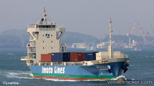
Vessel Daikoku IMO: 9624392, MMSI: 431003009 General Cargo Ship
UTC, 34.61280, 135.26608, course: 284, speed: 0.3
UTC, 34.61283, 135.26608, course: 287, speed: 0.1
2026-01-29 17:58:19 UTC, 34.61285, 135.26604, course: 288, speed: 0.1
Live AIS position:
UTC. Near Kobe),
updated 2026-01-29 17:58:19 UTC.
Find the position of the vessel Daikoku on the map. The latter are known coordinates and path.
marine traffic ship tracker show on live map
The current position of vessel Daikoku is 34.61285 lat / 135.26604 lng. Updated: 2026-01-29 17:58:19 UTCCurrently sailing under the flag of Japan
Daikoku built in 2011 year
Deadweight:
2000 tDetails:
Last coordinates of the vessel:
UTC, 34.51877, 134.72862, course: 66, speed: 13.6UTC, 34.61280, 135.26608, course: 284, speed: 0.3
UTC, 34.61283, 135.26608, course: 287, speed: 0.1
2026-01-29 17:58:19 UTC, 34.61285, 135.26604, course: 288, speed: 0.1