 vesseltracker.com
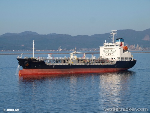
Vessel Sunny Noah IMO: 9474357, MMSI: 431003074 Chemical Oil Products Tanker
UTC, 26.06983, 127.61980, course: 298, speed: 14.5
UTC, 26.23395, 127.67745, course: 30, speed: 0.8
2026-02-06 03:42:44 UTC, 26.23762, 127.67808, course: 180, speed: 0
Live AIS position:
UTC. Near Urazoe, Okinawa),
updated 2026-02-06 03:42:44 UTC.
Find the position of the vessel Sunny Noah on the map. The latter are known coordinates and path.
marine traffic ship tracker show on live map
The current position of vessel Sunny Noah is 26.23762 lat / 127.67808 lng. Updated: 2026-02-06 03:42:44 UTCDetails:
Last coordinates of the vessel:
UTC, 26.28772, 128.06313, course: 207, speed: 13.2UTC, 26.06983, 127.61980, course: 298, speed: 14.5
UTC, 26.23395, 127.67745, course: 30, speed: 0.8
2026-02-06 03:42:44 UTC, 26.23762, 127.67808, course: 180, speed: 0