 vesseltracker.com
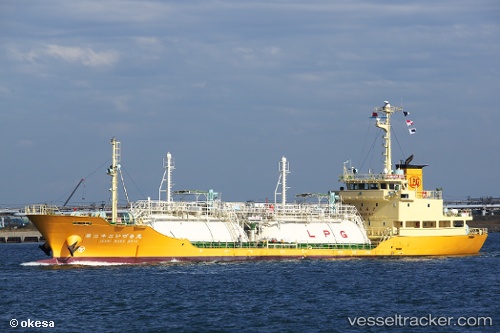
Vessel Izumi Maru No.22 IMO: 9644768, MMSI: 431004011 Lpg Tanker
UTC, 26.76333, 128.43832, course: -1, speed: 10
UTC, 26.60667, 128.31332, course: -1, speed: 10
2026-01-31 20:26:18 UTC, 26.22353, 127.93965, course: 247, speed: 10.3
Live AIS position:
UTC. Near Buckner Bay),
updated 2026-01-31 20:26:18 UTC.
Find the position of the vessel Izumi Maru No.22 on the map. The latter are known coordinates and path.
marine traffic ship tracker show on live map
The current position of vessel Izumi Maru No.22 is 26.22353 lat / 127.93965 lng. Updated: 2026-01-31 20:26:18 UTCDetails:
Last coordinates of the vessel:
UTC, 27.20667, 128.64833, course: -1, speed: 10UTC, 26.76333, 128.43832, course: -1, speed: 10
UTC, 26.60667, 128.31332, course: -1, speed: 10
2026-01-31 20:26:18 UTC, 26.22353, 127.93965, course: 247, speed: 10.3