 vesseltracker.com
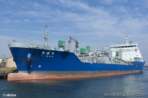
Vessel Kibou IMO: 9673288, MMSI: 431004512 Limestone Carrier
UTC, 37.23431, 141.02196, course: 91, speed: 0
UTC, 37.23431, 141.02196, course: 91, speed: 0
2026-03-01 06:23:53 UTC, 37.09316, 141.04797, course: 180, speed: 12.7
Live AIS position:
UTC. 13 nm NE of ONAHAMA),
updated 2026-03-01 06:23:53 UTC.
Find the position of the vessel Kibou on the map. The latter are known coordinates and path.
marine traffic ship tracker show on live map
The current position of vessel Kibou is 37.09316 lat / 141.04797 lng. Updated: 2026-03-01 06:23:53 UTCDetails:
Last coordinates of the vessel:
UTC, 37.23431, 141.02196, course: 91, speed: 0UTC, 37.23431, 141.02196, course: 91, speed: 0
UTC, 37.23431, 141.02196, course: 91, speed: 0
2026-03-01 06:23:53 UTC, 37.09316, 141.04797, course: 180, speed: 12.7