 vesseltracker.com
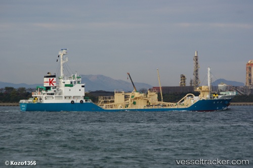
Vessel Kirishima Maru IMO: 9671254, MMSI: 431004901 Cement Carrier
UTC, -84.35029, -110.88661, course: 197, speed: 34.3
UTC, -84.35029, -110.88661, course: 197, speed: 34.3
2026-02-10 03:23:37 UTC, -84.35029, -110.88661, course: 197, speed: 34.3
Live AIS position:
UTC. Open sea (no nearby ports in database)),
updated 2026-02-10 03:23:37 UTC.
Find the position of the vessel Kirishima Maru on the map. The latter are known coordinates and path.
marine traffic ship tracker show on live map
The current position of vessel Kirishima Maru is -84.35029 lat / -110.88661 lng. Updated: 2026-02-10 03:23:37 UTCCurrently sailing under the flag of Japan
Details:
Last coordinates of the vessel:
UTC, -22.14571, -110.88661, course: 197, speed: 34.3UTC, -84.35029, -110.88661, course: 197, speed: 34.3
UTC, -84.35029, -110.88661, course: 197, speed: 34.3
2026-02-10 03:23:37 UTC, -84.35029, -110.88661, course: 197, speed: 34.3