 vesseltracker.com
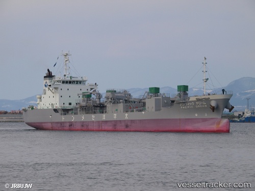
Vessel Pacific Dream IMO: 9690573, MMSI: 431005521 Cement Carrier
UTC, 35.40642, 139.75006, course: 69, speed: 0.1
UTC, 35.40578, 139.75153, course: 345, speed: 0.2
2026-01-28 11:41:09 UTC, 35.40568, 139.75157, course: 335, speed: 0.1
Live AIS position:
UTC. Near Naka-Ku, Kanagawa),
updated 2026-01-28 11:41:09 UTC.
Find the position of the vessel Pacific Dream on the map. The latter are known coordinates and path.
marine traffic ship tracker show on live map
The current position of vessel Pacific Dream is 35.40568 lat / 139.75157 lng. Updated: 2026-01-28 11:41:09 UTCDetails:
Last coordinates of the vessel:
UTC, 35.52056, 139.91585, course: 244, speed: 13.1UTC, 35.40642, 139.75006, course: 69, speed: 0.1
UTC, 35.40578, 139.75153, course: 345, speed: 0.2
2026-01-28 11:41:09 UTC, 35.40568, 139.75157, course: 335, speed: 0.1