 vesseltracker.com
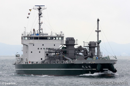
Vessel Kaizanmaru IMO: 9739173, MMSI: 431006227 Cement Carrier
UTC, 34.40122, 133.89983, course: 249, speed: 12.4
UTC, 34.24948, 133.38177, course: 256, speed: 11.7
2026-02-02 16:27:17 UTC, 34.13853, 132.87238, course: 222, speed: 15.5
Live AIS position:
UTC. Near OKAMURA),
updated 2026-02-02 16:27:17 UTC.
Find the position of the vessel Kaizanmaru on the map. The latter are known coordinates and path.
marine traffic ship tracker show on live map
The current position of vessel Kaizanmaru is 34.13853 lat / 132.87238 lng. Updated: 2026-02-02 16:27:17 UTCCurrently sailing under the flag of Japan
Details:
Last coordinates of the vessel:
UTC, 34.42470, 134.39635, course: 248, speed: 12.4UTC, 34.40122, 133.89983, course: 249, speed: 12.4
UTC, 34.24948, 133.38177, course: 256, speed: 11.7
2026-02-02 16:27:17 UTC, 34.13853, 132.87238, course: 222, speed: 15.5