 vesseltracker.com
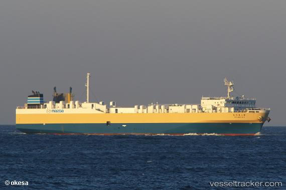
Vessel Toyo Maru No.3 IMO: 9755751, MMSI: 431007419 Vehicles Carrier
UTC, 34.35511, 132.51341, course: 240, speed: 0
UTC, 34.35513, 132.51347, course: 240, speed: 0
2026-01-25 17:39:24 UTC, 34.35513, 132.51344, course: 240, speed: 0
Live AIS position:
UTC. Near Aki-gun/Hiroshima),
updated 2026-01-25 17:39:24 UTC.
Find the position of the vessel Toyo Maru No.3 on the map. The latter are known coordinates and path.
marine traffic ship tracker show on live map
The current position of vessel Toyo Maru No.3 is 34.35513 lat / 132.51344 lng. Updated: 2026-01-25 17:39:24 UTCDetails:
Last coordinates of the vessel:
UTC, 34.35512, 132.51340, course: 240, speed: 0UTC, 34.35511, 132.51341, course: 240, speed: 0
UTC, 34.35513, 132.51347, course: 240, speed: 0
2026-01-25 17:39:24 UTC, 34.35513, 132.51344, course: 240, speed: 0